Kharg Island, a small island off Iran’s coast, handles about 90% of the country’s crude oil exports. Many of the tankers that call there send no AIS position, so standard ship trackers lose sight of them. Satellites don’t.
We combine radar and optical imagery from five satellite constellations, measure every tanker we find, and turn its length into the oil it can carry. Radar sees through cloud and darkness. Two moments from the past 18 months show what that reveals.
June 2025: Airstrike empties anchorage in five days
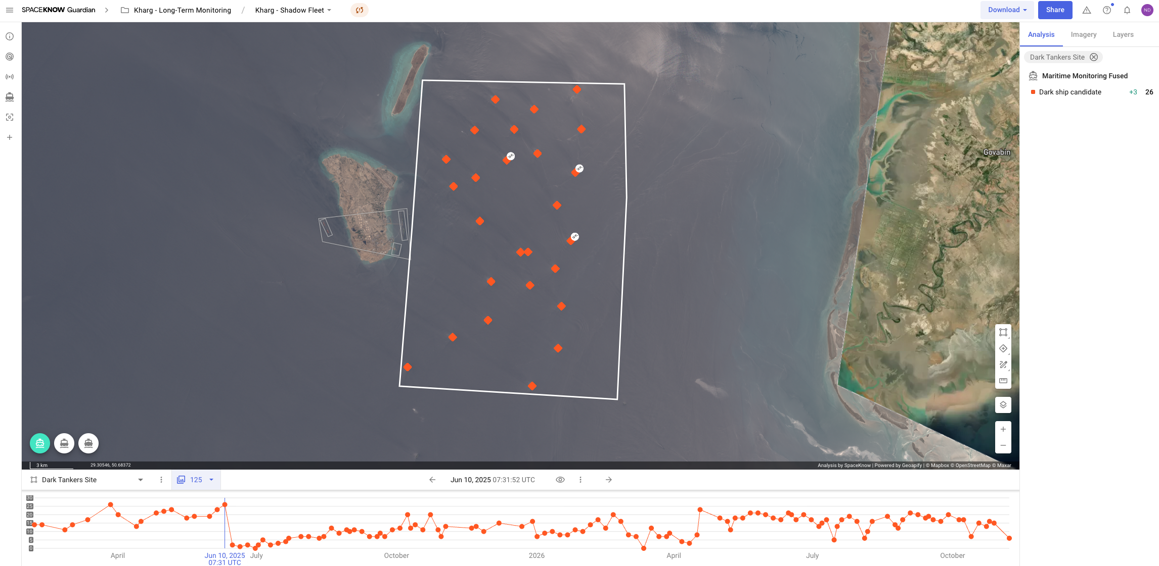
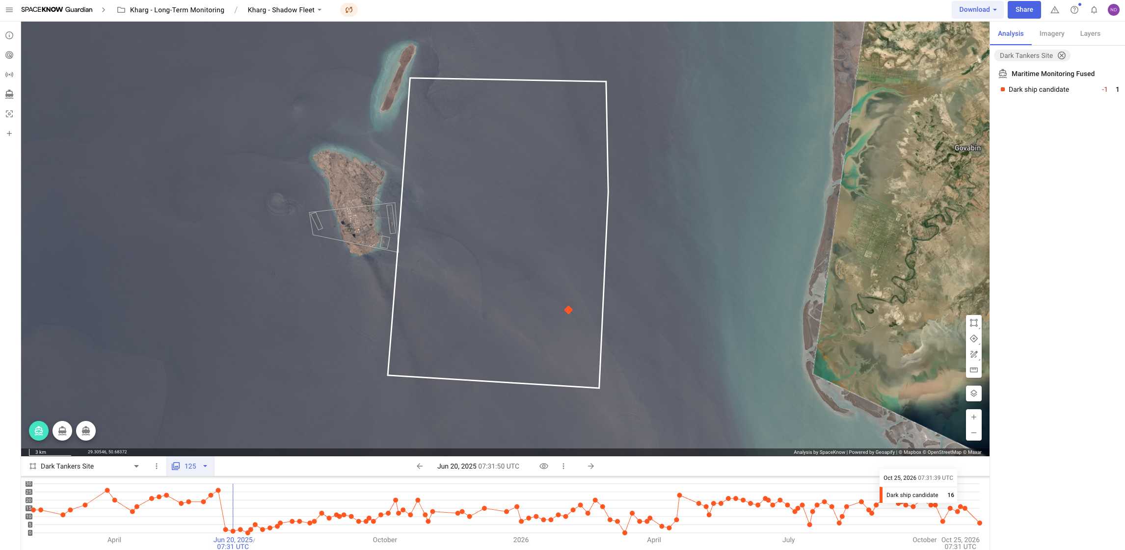
Through May and early June 2025, a fleet of large tankers sat at anchor a few kilometres east of Kharg. On 10 June our satellites still counted 19 of them, mostly supertankers, together able to hold about 40 million barrels. Over 9 in 10 of the tankers anchored there showed no AIS signal.
On 13 June, Israel launched strikes on Iran. By 15 June the anchorage was empty, and a satellite pass the next day confirmed it. Iran had dispersed its tankers across the Gulf, away from a likely target, as it did in October 2024. For the rest of June, our imagery never showed more than one large tanker there.
April 2026: Measuring exports through a blockade
On 13 April 2026, the US began a naval blockade of Iranian ports. Kharg kept working. Between 24 and 30 April our imagery shows two supertankers, each able to carry about 2 million barrels, and a mid-size Suezmax tanker loading at the jetties.
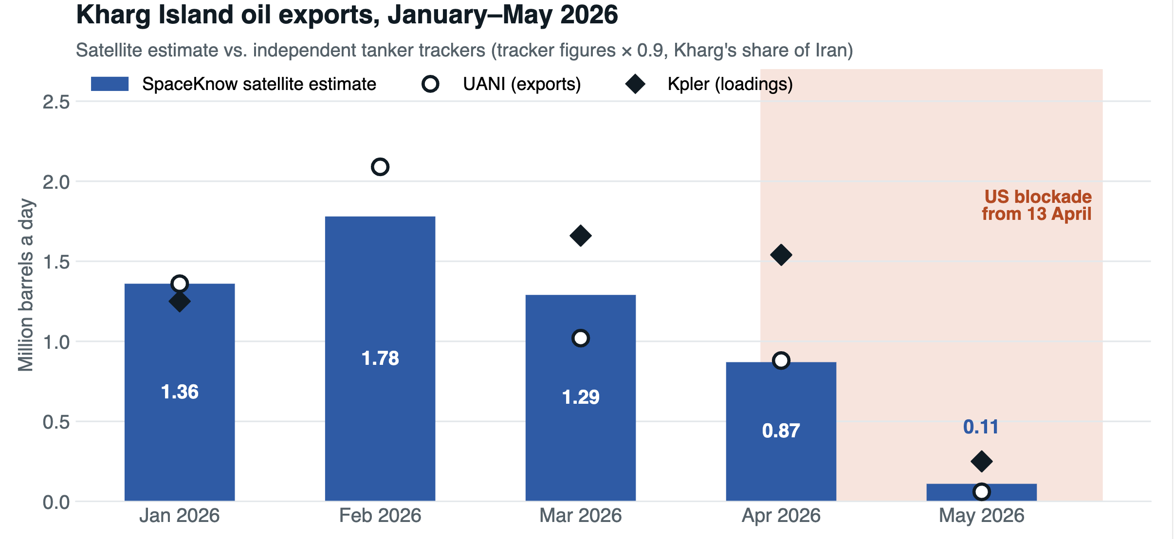
Measuring every tanker over the month, we estimate Kharg’s April exports at about 0.9 million barrels a day. That is a third less than in January, and it matches independent tanker tracking by UANI almost exactly. In January our ship-by-ship count came to 42 million barrels, against 39–42 million reported by industry trackers.
More than half of the tankers we saw leaving Kharg’s jetties in April sent no AIS signal. Many loaded ships also had nowhere to go. Tankers waiting offshore rose from about 7 in April to 16 in May, almost all of them with no AIS signal. With exports blocked, Iran was storing oil at sea.
How we measure
- See every ship. Radar (Sentinel-1) works day and night through cloud. Optical satellites (Sentinel-2, PlanetScope, Satellogic, SkySat) add detail. SpaceKnow’s detectors find every vessel on each image, whether or not it broadcasts AIS.
- Measure it. A tanker’s length tells us its class and its deadweight, and so how much oil it can carry. A 330 m supertanker carries about 2 million barrels.
- Follow it. By tracking which berths are occupied from image to image, we rebuild each tanker’s stay at the terminal and when it left.
- Check it. We compare our monthly totals with independent tanker trackers.
Figures are SpaceKnow satellite estimates of what tankers can carry, based on their measured size; satellites cannot see how full a ship is. Tracker figures cover all of Iran and are multiplied by 0.9 for Kharg’s share. The satellite export estimate’s scale was set once using January 2026; every other month is an independent comparison. “No AIS signal” means no AIS position was matched to the ship, which can also be caused by jamming or poor reception in the Gulf.
